The wave
We separated the scan into layers: sea, foam, boats, Mount Fuji and sky. We gave them depth so they would line up from the starting camera position. Moving the camera reveals the relief and the parts we had to fill in.
Hokusai / Working notes
We wanted to enter The Great Wave: pass beneath the crest and explore the landscape we imagined behind the print.
Pilot film and studies for a work in progress · 2026
In this pilot, the camera passes beneath the crest and moves towards the village. The wave stays still; the camera does the moving.
01 / The history
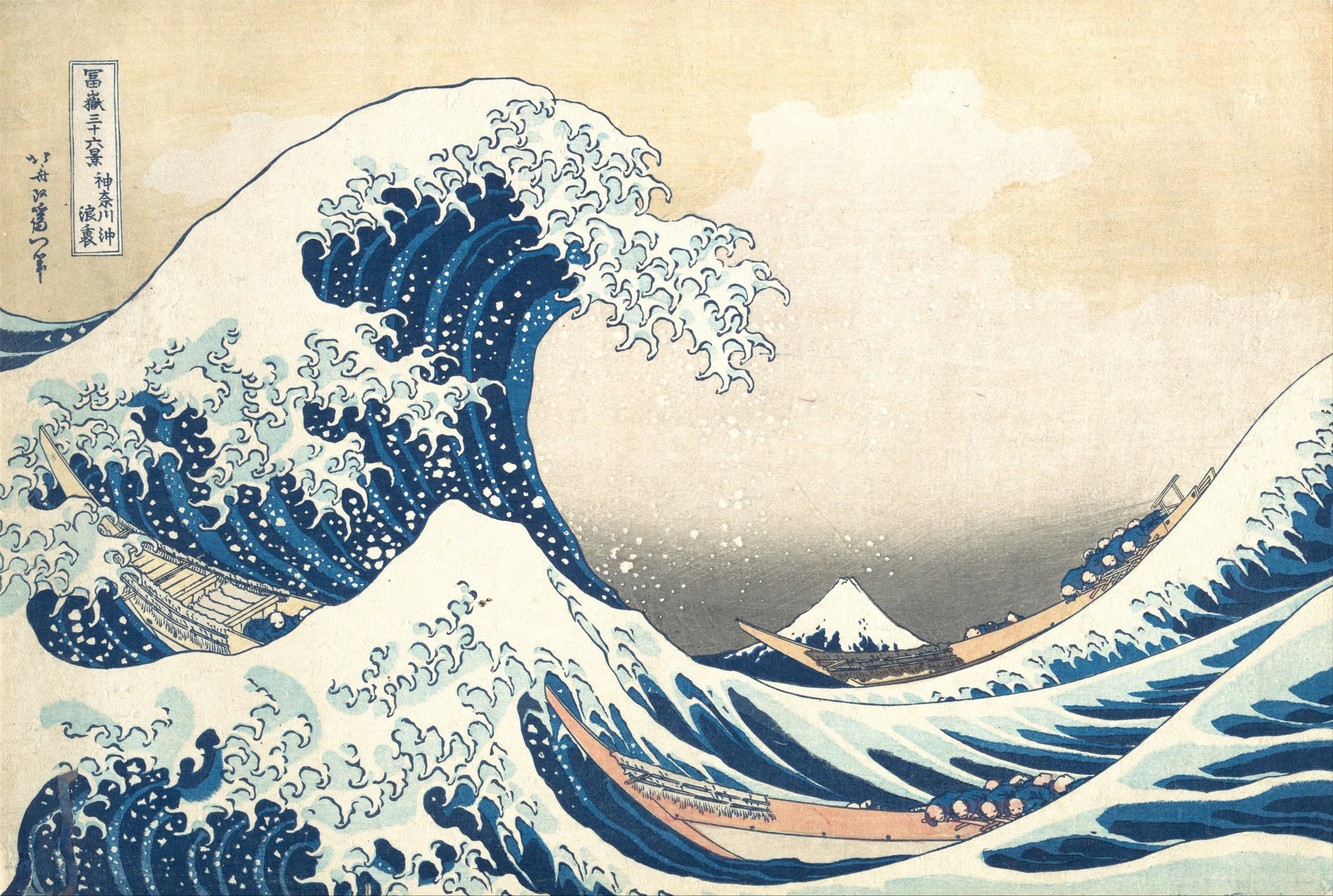
Hokusai was born in Edo in 1760. He was around seventy when he made The Great Wave, about 1830–32. It is one of the Thirty-six Views of Mount Fuji, a series showing the mountain from different places and amid everyday life.
The wave draws most of our attention, though Mount Fuji gives the series its name. Here it appears small in the distance, beneath the crest. Hokusai plays with that difference in size and with the blues of the water and the mountain.
We started with an impression held by the Met. We kept its drawing as our reference and began to build what the image leaves out of view: the sides of the wave, the coast, the roads and the villages.
See the print at the Met02 / The landscape
The route passes through Kanagawa, Enoshima and Hakone, approaches Mount Fuji and ends in Edo. These images show stages of the work, including the latest village studies.
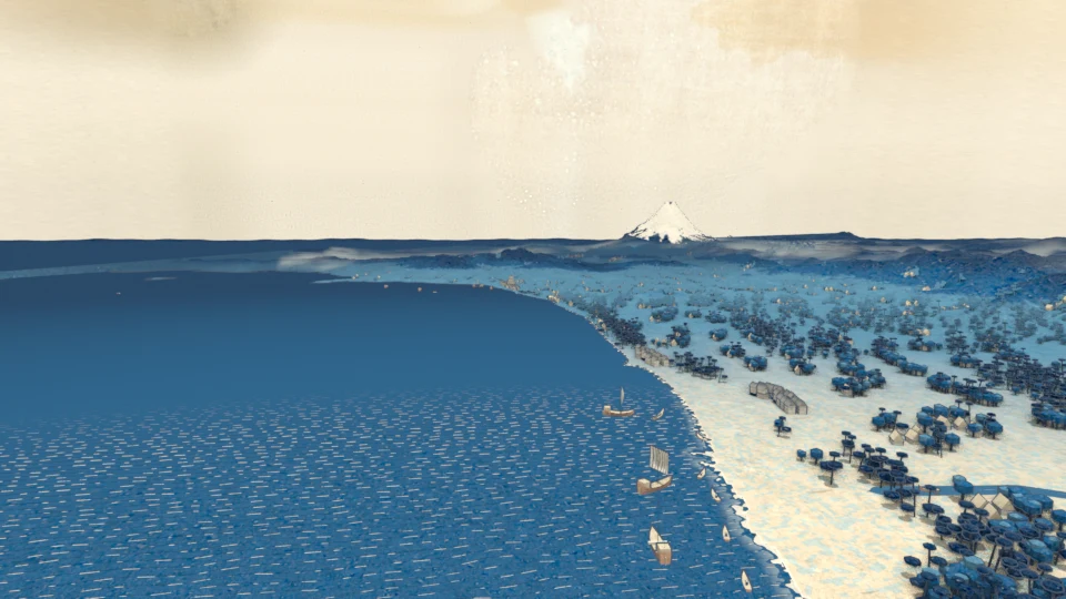
The Sagami coast, with boats, roads and the new villages.
We cut these passages from the longer journey so they can be watched on their own. They come from a version made before the new villages were added.
03 / The map
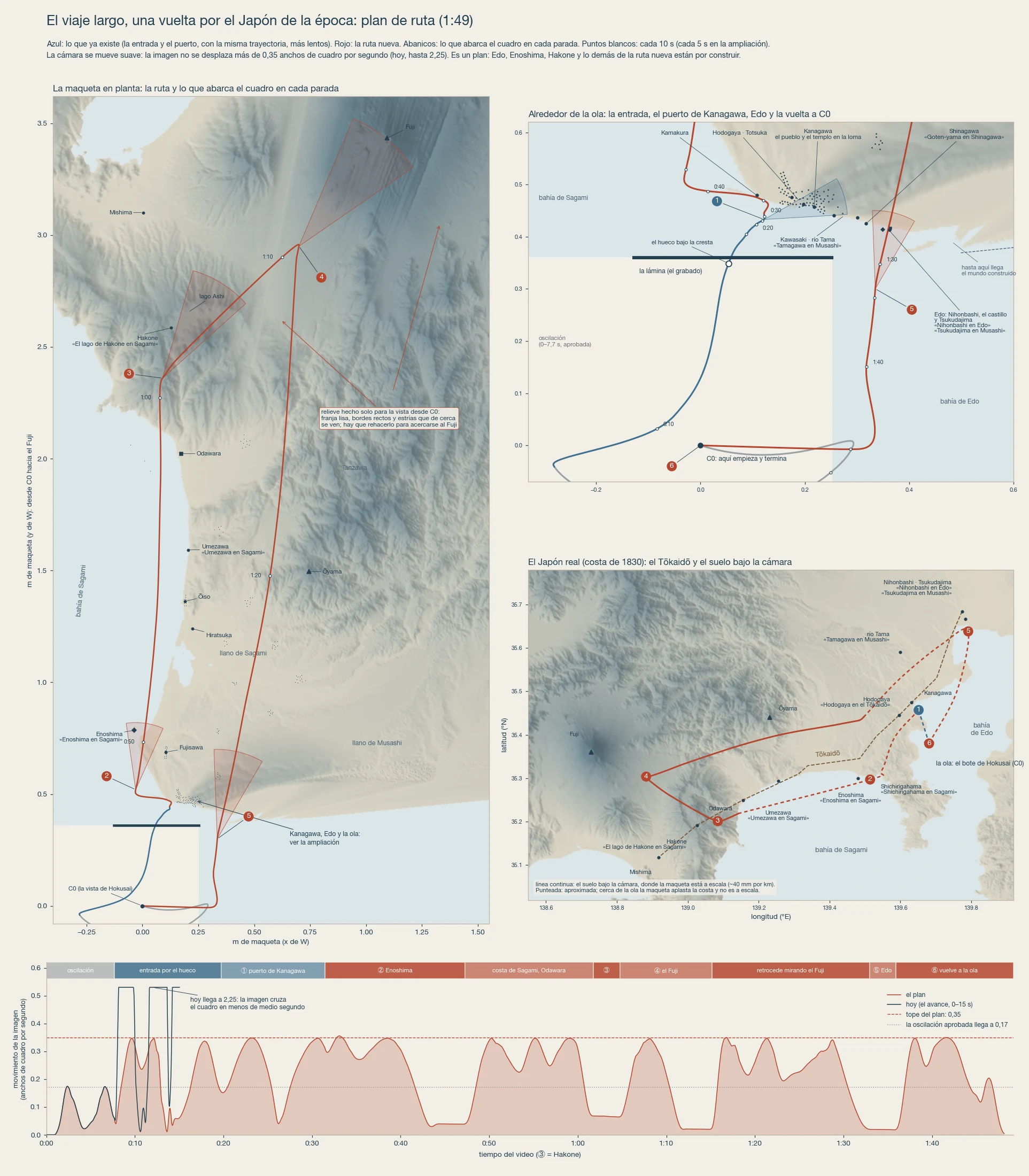
The journey connects real places, with distances and sizes adjusted for the model. We brought the coast, the mountains and Edo closer together to travel through them in under two minutes, keeping the colours and appearance of the print.
04 / How we made it
The sources tell us different things. Maps from 1880–86, for example, help us study how villages were arranged; using them as a reference for 1830 involves interpretation. We also decided how much to enlarge the houses so they remain visible, and how to connect the places along the route.
We separated the scan into layers: sea, foam, boats, Mount Fuji and sky. We gave them depth so they would line up from the starting camera position. Moving the camera reveals the relief and the parts we had to fill in.
We used elevation data from Japan’s GSI to shape the terrain. For the villages, we consulted prints, settlement records and historical maps. That research led us to add more villages inland and leave parts of the coast more open.
We tried several entrances and chose the direct passage beneath the crest. We then adjusted the speed and height to allow time to look at the villages, follow the coast and approach Mount Fuji.
The source print and the main references we used to build the world.
Print: H. O. Havemeyer Collection, Bequest of Mrs. H. O. Havemeyer, 1929. Public-domain image. Elevation: 出典:国土地理院(地理院タイル). The world studies are interpretations by Lothal.
Work, modelling and camera journey: Lothal Studio · 2026. Pilot film and studies for a work in progress.